You are here

Map

Virtual Volunteers Use Twitter And Facebook To Make Maps Of Nepal

Kathmandu Living Labs' earthquake site collects data about conditions and needs. Each blue dot represents the number of reports of help wanted — medical, food, water or shelter — near Kathmandu. Kathmandu Living Labs

Image: Kathmandu Living Labs' earthquake site collects data about conditions and needs. Each blue dot represents the number of reports of help wanted — medical, food, water or shelter — near Kathmandu. Kathmandu Living Labs

npr.org - May 5th 2015 - David Lagesse

These pleas for help in the aftermath of the Nepal earthquake have popped up on ever changing maps of the disaster zone, compiled and posted by hundreds of digital volunteers around the globe. They've not been to Nepal and very likely haven't met each other, instead working together through online forums and chat rooms and posting their work to Web documents and maps.

(VIEW COMPLETE ARTICLE)

Country / Region Tags: 
Problem, Solution, SitRep, or ?: 

A Force for Good: How Digital Jedis are Responding to the Nepal Earthquake (Updated)

A building and statue damaged by the April 25th quake.

Image: A building and statue damaged by the April 25th quake.

irevolution.net - April 27th 2015

Digital Humanitarians are responding in full force to the devastating earthquake that struck Nepal. Information sharing and coordination is taking place online via CrisisMappers and on multiple dedicated Skype chats. The Standby Task Force (SBTF), Humanitarian OpenStreetMap (HOT) and others from the Digital Humanitarian Network (DHN) have also deployed in response to the tragedy.

(VIEW COMPLETE ARTICLE)

Country / Region Tags: 
General Topic Tags: 
Problem, Solution, SitRep, or ?: 

United Nations General Assembly Adopts Resolution on Global Geospatial Information Management


un.org - February 26, 2015

Delegates in the General Assembly of the United Nations adopted a consensus resolution last week, by which they addressed global geospatial information management. The document entitled “A global geodetic reference frame for sustainable development” (A/RES/69/266) urges States to voluntarily implement open sharing of geodetic data, standards and conventions, inviting them to improve national geodetic infrastructure and engage in multilateral cooperation that addressed infrastructure gaps and duplications, towards the development of a more sustainable geodetic reference frame.

(READ COMPLETE ARTICLE)

(ALSO SEE RELATED INFORMATION HERE)

Country / Region Tags: 
General Topic Tags: 
Problem, Solution, SitRep, or ?: 

CDC - Mapping for Ebola: A Collaborative Effort


cdc.gov - January 14, 2015

One of the difficulties faced by teams responding to the current Ebola outbreak in West Africa is identifying individuals and communities residing in remote areas. Existing maps of these regions either do not exist or are inadequate or outdated. This means that basic data like location of houses, buildings, villages, and roads are not easily accessible, and case finding and contact tracing can be extremely difficult.

To help aid the outbreak response effort, volunteers from around the world are using an open-source online mapping platform called OpenStreetMap (OSM) to create detailed maps and map data of Guinea, Sierra Leone, Liberia, and parts of Mali.

(READ COMPLETE ARTICLE)

Country / Region Tags: 
Problem, Solution, SitRep, or ?: 

Ebola: Better Maps Could Have Helped Fight Virus

How Maps Could Help Fight Ebola

SKY NEWS                                             Oct. 0, 2014

By Tom Cheshire, Technology Correspondent

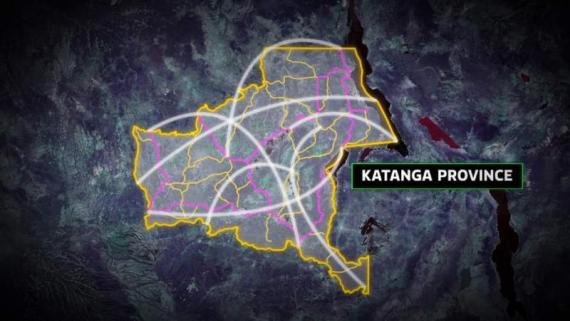
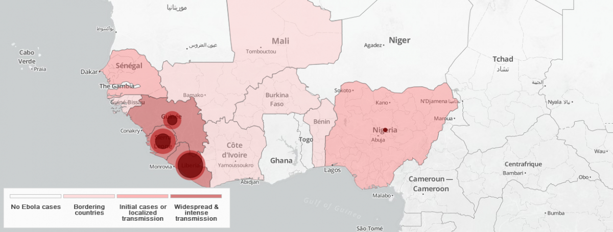
LONDON -- Better maps could have helped contain the deadly Ebola virus, according to Medecins Sans Frontieres.

Ivan Gaytan, technology advisor to MSF, told Sky News the disease is "preventable" and could have been "easier to contain" if there was more knowledge of the region.

He said: "In any country where Ebola or any other infectious disease arrives, if you already have a good map which actually reflects the way people describe geography, you set up your clinical activities to take that data in the first place in the right way."

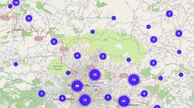
MSF, also known as Doctors Without Borders, will launch a project next month called Missing Maps, which lets anyone, anywhere in the world, annotate maps to show dwellings and infrastructure.

Country / Region Tags: 
Problem, Solution, SitRep, or ?: 

World Health Organization (WHO) - Ebola Portal - Map

                              (FOR THE INTERACTIVE MAP - CLICK ON THE MAP IMAGE BELOW)


https://who-ocr.github.io/ebola-data/

Country / Region Tags: 
General Topic Tags: 
Problem, Solution, SitRep, or ?: 

Ebola outbreak - map of affected areas

Ebola outbreak map, chart

Country / Region Tags: 
Problem, Solution, SitRep, or ?: 

Spread of Ebola virus

Country / Region Tags: 
General Topic Tags: 
Problem, Solution, SitRep, or ?: 

Crowdsourcing a Crisis Map of UAV/Aerial Videos for Disaster Response

The UAV Map, which will go live shortly, is inspired by Travel by Drone Map displayed above.

Image: The UAV Map, which will go live shortly, is inspired by Travel by Drone Map displayed above.

irevolution.net - June 18th, 2014 - Patrick Meier

Journalists and citizen journalists are already using small UAVs during disasters. And some are also posting their aerial videos online: Typhoon Haiyan (Yolanda), Moore Tornado, Arkansas Tornado and recent floods in Florida, for example. Like social media, this new medium—user-generated (aerial) content—can be used by humanitarian organizations to augment their damage assessments and situational awareness.

(VIEW COMPLETE ARTICLE)

Country / Region Tags: 
Problem, Solution, SitRep, or ?: 

Pages

Subscribe to Map
howdy folks