You are here

Maps - Global

Primary tabs

This working group is focused on discussions about maps.

The mission of this working group is to focus on discussions about maps.

Members

Hank Rappaport Kathy Gilbeaux mdmcdonald typackett

Email address for group

maps-global@m.resiliencesystem.org

United Nations General Assembly Adopts Resolution on Global Geospatial Information Management


un.org - February 26, 2015

Delegates in the General Assembly of the United Nations adopted a consensus resolution last week, by which they addressed global geospatial information management. The document entitled “A global geodetic reference frame for sustainable development” (A/RES/69/266) urges States to voluntarily implement open sharing of geodetic data, standards and conventions, inviting them to improve national geodetic infrastructure and engage in multilateral cooperation that addressed infrastructure gaps and duplications, towards the development of a more sustainable geodetic reference frame.

(READ COMPLETE ARTICLE)

(ALSO SEE RELATED INFORMATION HERE)

Country / Region Tags: 
General Topic Tags: 
Problem, Solution, SitRep, or ?: 

CDC - Mapping for Ebola: A Collaborative Effort


cdc.gov - January 14, 2015

One of the difficulties faced by teams responding to the current Ebola outbreak in West Africa is identifying individuals and communities residing in remote areas. Existing maps of these regions either do not exist or are inadequate or outdated. This means that basic data like location of houses, buildings, villages, and roads are not easily accessible, and case finding and contact tracing can be extremely difficult.

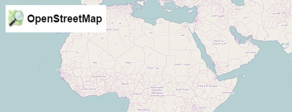
To help aid the outbreak response effort, volunteers from around the world are using an open-source online mapping platform called OpenStreetMap (OSM) to create detailed maps and map data of Guinea, Sierra Leone, Liberia, and parts of Mali.

(READ COMPLETE ARTICLE)

Country / Region Tags: 
Problem, Solution, SitRep, or ?: 

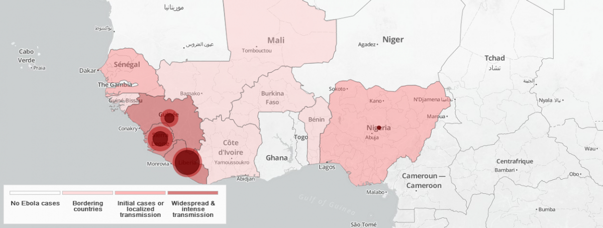
World Health Organization (WHO) - Ebola Portal - Map

                              (FOR THE INTERACTIVE MAP - CLICK ON THE MAP IMAGE BELOW)


https://who-ocr.github.io/ebola-data/

Country / Region Tags: 
General Topic Tags: 
Problem, Solution, SitRep, or ?: 

Crowdsourcing a Crisis Map of UAV/Aerial Videos for Disaster Response

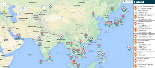
The UAV Map, which will go live shortly, is inspired by Travel by Drone Map displayed above.

Image: The UAV Map, which will go live shortly, is inspired by Travel by Drone Map displayed above.

irevolution.net - June 18th, 2014 - Patrick Meier

Journalists and citizen journalists are already using small UAVs during disasters. And some are also posting their aerial videos online: Typhoon Haiyan (Yolanda), Moore Tornado, Arkansas Tornado and recent floods in Florida, for example. Like social media, this new medium—user-generated (aerial) content—can be used by humanitarian organizations to augment their damage assessments and situational awareness.

(VIEW COMPLETE ARTICLE)

Country / Region Tags: 
Problem, Solution, SitRep, or ?: 

Ecological Footprint of Consumption Compared to Biocapacity

This map compares each country's total consumption Footprint with the biocapacity available within its own borders.

Many countries rely, in net terms, on the biocapacity of other nations to meet domestic demands for goods and services. For example: Japan imports Ecuadorian wood to make paper; Europe imports meat fed on Brazilian soy; the United States imports Peruvian cotton; and China obtains lumber from Tanzania.

  • World Total Biocapacity: 1.78 gha per capita
  • World Ecological Footprint of Consumption: 2.7 gha per capita (i.e. we are using more resources than the Earth can provide.)

Currently less than 20 percent of the world's population living in countries that can keep up with their own demands.

What is a global hectare (gha)?

A global hectare is a common unit that encompasses the average productivity of all the biologically productive land and sea area in the world in a given year. Biologically productive areas include cropland, forest and fishing grounds, and do not include deserts, glaciers and the open ocean.

Data source: Global Footprint Network's 2010 Edition.

Country / Region Tags: 
General Topic Tags: 
Problem, Solution, SitRep, or ?: 

Pages

howdy folks