You are here

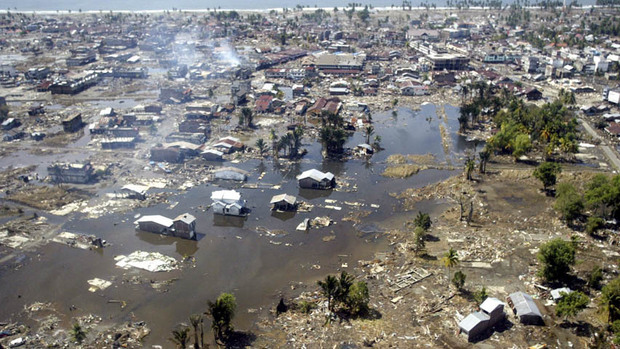
In this Jan. 2, 2005 file photo, a wide area of destruction is shown from an aerial view taken over Meulaboh, 250 kilometers (156 Miles) west of Banda Aceh, Indonesia. Researchers in the United States are hoping to use GPS data to speed up current warnings. (AP Photo/Dita Alangkara, File)
U.S. seismologists currently testing new warning system
by Andrew Pinsent - CBC News - May 5, 2012
Scientists in the United States have been testing an advanced tsunami warning system using GPS data, combined with traditional seismology networks, to attempt to detect the magnitude of an earthquake faster so warnings of potential tsunamis can get out to potentially affected areas sooner.
The prototype is called California Integrated Seismic Network (CISN), and is a collaboration between the United States Geological Survey (USGS) and The Gordon and Betty Moore Foundation, whose focus is on environmental conservation.
The foundation has given a grant of $6 million (US) to seismologists at the University of California, Berkeley, California Institute of Technology (Caltech), and University of Washington, Seattle, in order to find the most efficient way to capture and analyze seismic data to ensure adequate warning can be given to people on the ground.


Recent Comments