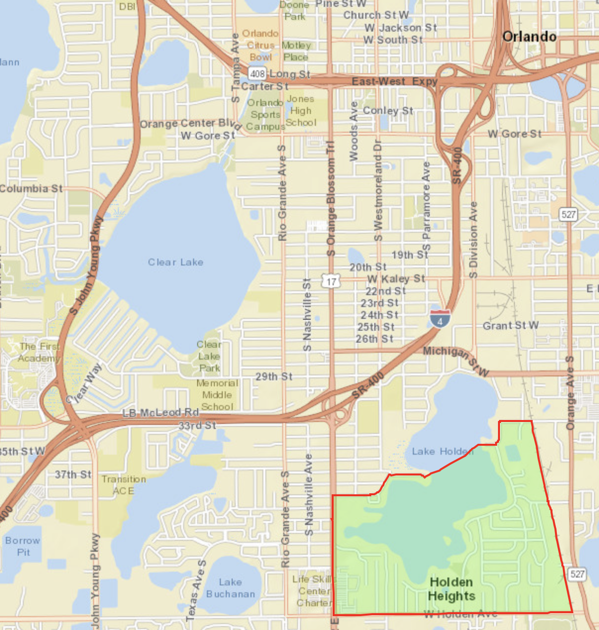
Holden Heights, Orlando Location Detail

Return to Dashboard

Zip Codes Surveyed

Census Tracts Surveyed

Census Block Groups Surveyed

Holden Heights, Orlando, is served by the Orange County Unified School District. It is in Congressional District FL-10, State Senate Districts FL-11 and FL-13, and State House Districts FL-46 and FL-47.


Click on BOLD text for detail.


Holden Heights, Orlando

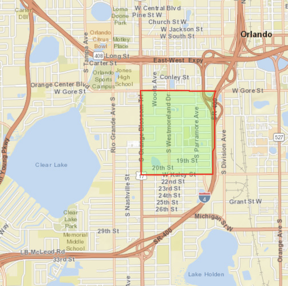
Census Block Group 120950185001  

Population:  2,298

  • W Gore to the North
  • W Kaley St to the South
  • I-4 to the East
  • Orange Blossom Trail to the West


Holden Heights, Orlando

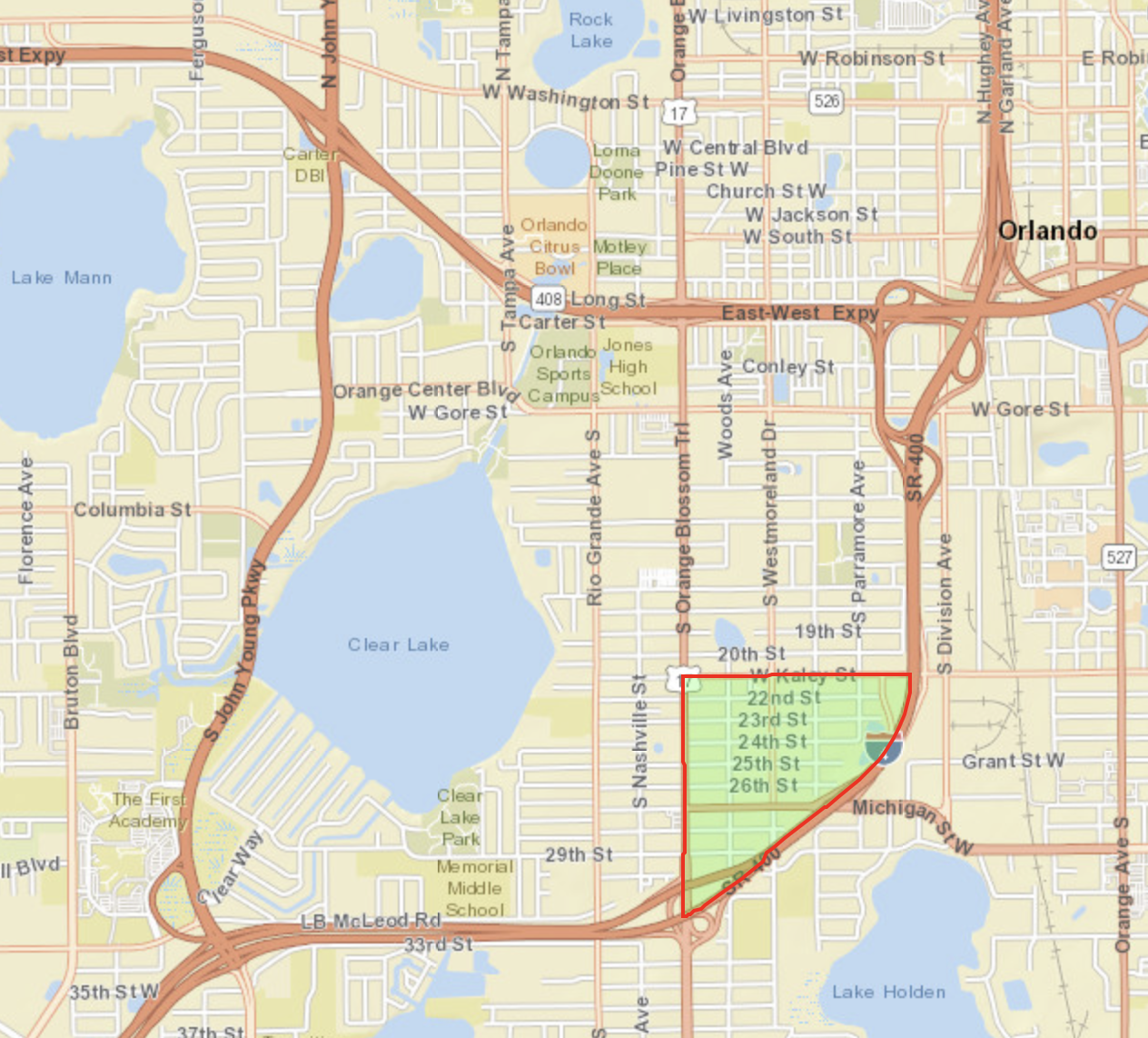
Census Block Group 120950185002

Population: 548

  • W Kaley St to the North
  • I-4 to East and South
  • Orange Blossom Trail to the West


Holden Heights, Orlando

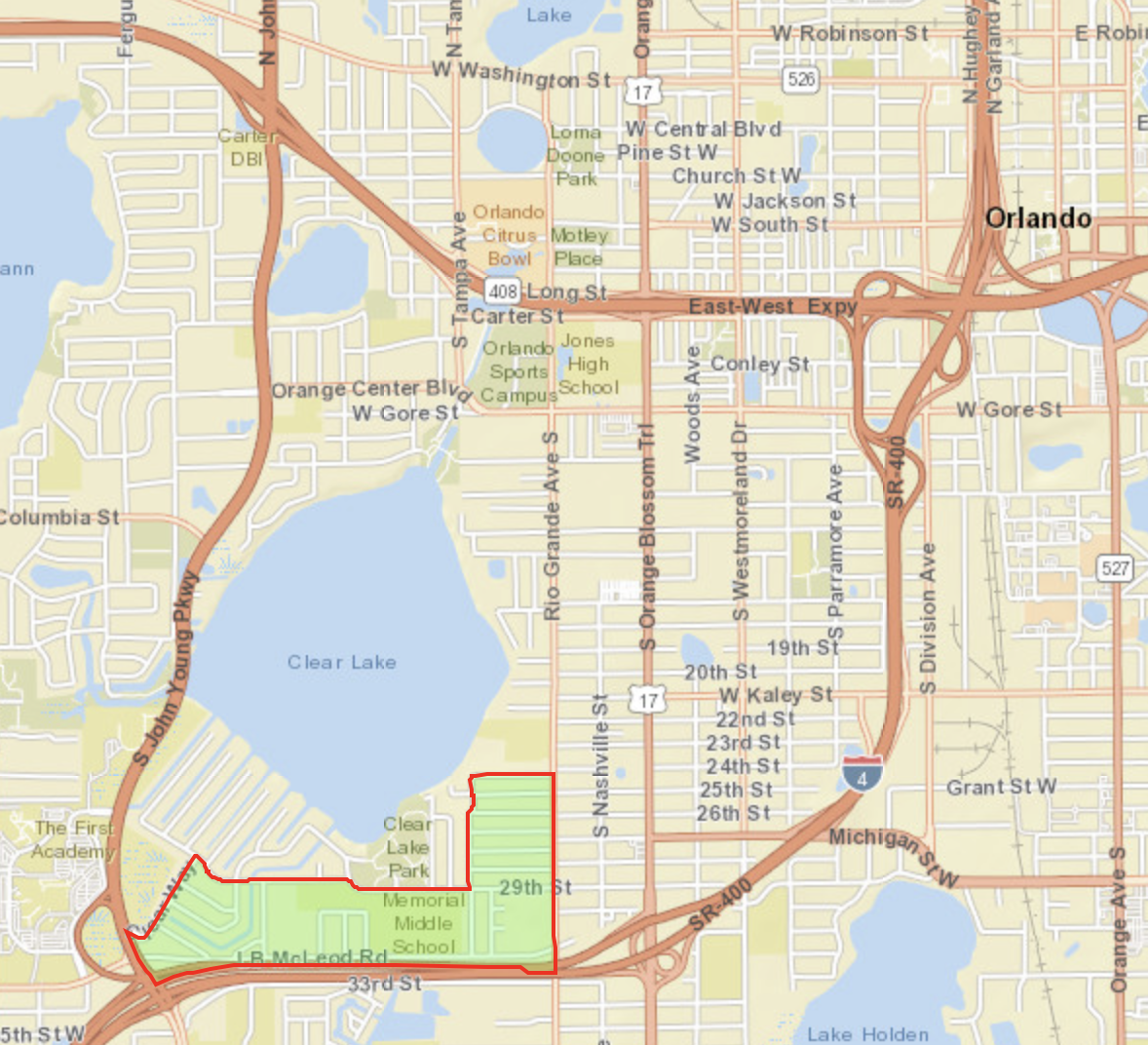
Census Block Group 120950116003

Population: 1,900

  • 29th St and 24th St to the North
  • I-4 to the South
  • Rio Grande Ave S to the East
  • Clear Way to the West


Holden Heights, Orlando

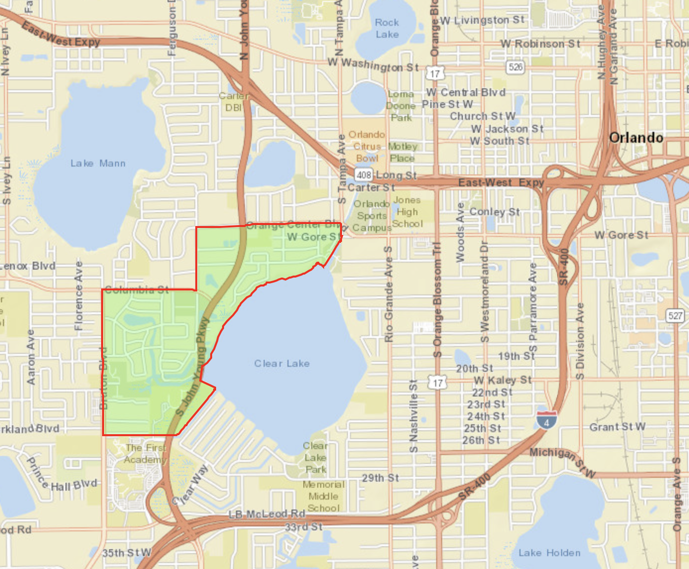
Census Block Group 120950117022

Population: 2,124

  • Orange Center Blvd to the North
  • Chandler St to the South
  • Clear Lake to the East
  • Bruton Blvd to the West

Unincorporated Holden Heights

Census Block Group 120950144002

Population: 2,541

  • Lake Holden to the North
  • W Holden Ave to the South
  • Railroad tracks to the East
  • S Orange Blossom Trail to the West


Surveys discussed on this page were conducted under the auspices of Health Initiatives Foundation, Inc.’s Florida Disaster Resilience Initiative with funding from The Miami Foundation. 

Website designed by Heron Bridge Education, Inc. for Health Initiatives Foundation, Inc. (2019)

Copyright © 2019 AGRR Initiative, Health Initiatives Foundation, Inc., All Rights Reserved