You are here
New Field Guide Explores Open Data Innovations in Disaster Risk and Resilience
Primary tabs
New Field Guide Explores Open Data Innovations in Disaster Risk and Resilience
Mon, 2014-03-31 21:16 — Kathy Gilbeaux
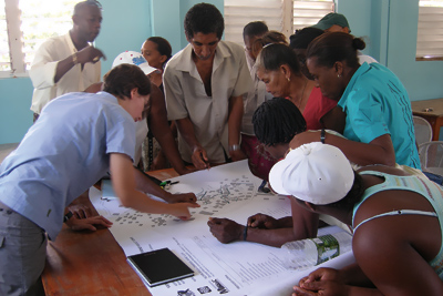
Citizen mapping can help pinpoint damage and locate risks, such as hillside instability that could threaten communities. GFDRR
worldbank.org - March 19, 2014
- The new World Bank Group field guide provides practical guidance for governments and organizations as they build their own open data programs for addressing disaster risk and resilience.
- It shows how participatory mapping projects can fill in government data gaps and keep existing data relevant as cities rapidly expand.
- Among the guide’s success stories are projects that quickly mapped disaster damage in the Philippines after Typhoon Yolanda and helped improve urban planning in Kathmandu.
CLICK HERE - Open Data for Resilience Initiative: Field Guide (134 page .PDF file)
Country / Region Tags:
General Topic Tags:
Problem, Solution, SitRep, or ?:
Groups this Group Post belongs to:

Recent Comments