You are here

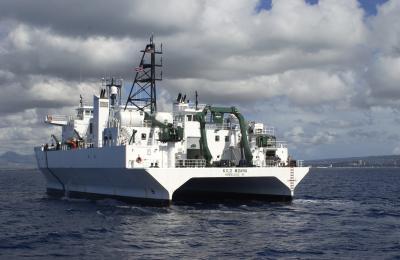
While in transit from Hawaii to Guam, the research vessel Kilo Moana detected the February 2010 Chilean tsunami. Credit: University of Hawaii, SOEST
submitted by Samuel Bendett
Homeland Security News Wire - May 8, 2012
Researchers find that commercial ships travel across most of the globe and could provide better warnings for potentially deadly tsunamis; this finding came as a surprise because tsunamis have such small amplitudes in the deep water, in contrast to their size when they reach the coastline, that it seemed unlikely that the tsunami would be detected using GPS unless the ship was very close to the source and the tsunami was very big
Commercial ships travel across most of the globe and could provide better warnings for potentially deadly tsunamis, according to a study published by scientists at the University of Hawaii – Manoa (UHM) and the National Oceanic and Atmospheric Administration’s Pacific Tsunami Warning Center.
James Foster, lead author and Assistant Researcher at the UH School of Ocean and Earth Science and Technology (SOEST), and colleagues were able to detect and measure the properties of the tsunami generated by the magnitude 8.8 earthquake in Maule, Chile (February 2010), even though, out in the open ocean, the wave was only about four inches (9.4 cm) high. The UH research vessel Kilo Moana was on its way from Hawaii to Guam at the time of the tsunami, and was equipped with geodetic GPS system recording data as the tsunami passed by.
(CLICK HERE TO READ THE COMPLETE ARTICLE)
http://manoa.hawaii.edu/news/article.php?aId=5084
Research Article - Improving tsunami warning using commercial ships


Recent Comments